Even before the Dust Bowl days of the 1930s, agricultural producers have recognized the economic and emotional devastation that drought can cause. Recently, the focus has shifted from dealing with drought as an unexpected hazard, to more proactive planning for the inevitability of drought. One of the tools available to producers is the U.S. Drought Monitor (USDM), a weekly map of drought conditions produced jointly by the USDA, the National Oceanic and Atmospheric Administration, and the National Drought Mitigation Center (NDMC) at the University of Nebraska-Lincoln.
Established in 1999, many sectors use the Drought Monitor. The media uses the map to communicate drought information. The USDA uses the map to distribute drought relief funds to agricultural producers, through programs such as the Livestock Forage Program (LFP). Some fire managers use the map to identify areas of potential fire danger. Policymakers may use the map to inform decision making, drought response, and relief actions.
U.S. Drought Monitor maps are released each Thursday morning at 8:30 E.T. The map is based on measurements of climatic, hydrologic, and soil conditions as well as reported impacts and observations from more than 350 contributors around the country. Eleven climatologists from partner organizations take turns serving as the lead author each week.
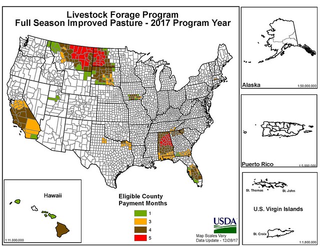
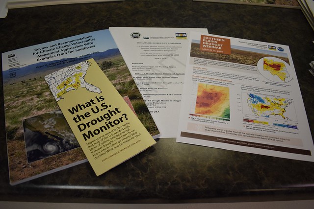
The Drought Monitor is considered the gold standard in identifying the location and severity of drought events. Shortly after its release, USDA began using the Drought Monitor as a trigger for several of its programs. In fact, the 2008 and 2014 versions of the Farm Bill mandate the use of the Drought Monitor to identify areas available for LFP relief and to calculate the level of support available to ranchers, leading to delivery of more than $6 billion for that program alone. In recent years, the USDA and NDMC have made the Drought Monitor and its companion products more useful to the public, including the addition of a Spanish-language version, data on regional drought impacts, and improvements to tools like the Drought Impact Reporter and an eligibility calculator for the LFP.
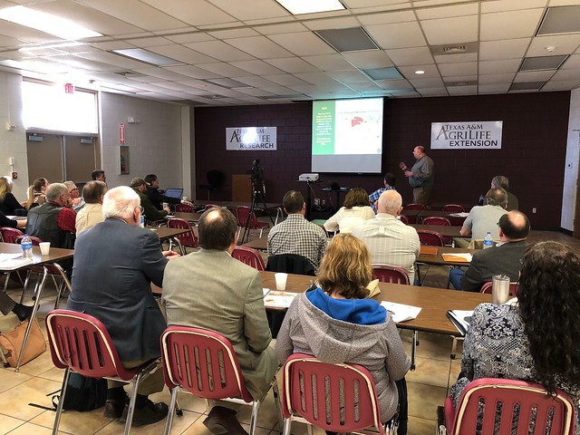
Some producers who are unfamiliar with how the Drought Monitor is produced question its accuracy. To allay concerns, the NDMC has developed a series of workshops in partnership with USDA’s Climate Hubs, 10 centers around the country which link USDA research and program agencies to deliver timely and authoritative resources to agricultural producers and professionals. These workshops instruct USDA field personnel on the history of the Drought Monitor, how it is produced, and its role in providing relief to the American farmer. In this way, USDA field personnel can help the public identify when they may be eligible for drought relief programs, provide them with information on weather and climate patterns common to their region, and recommend steps to mitigate the impacts of weather and climate extremes.
The first one-day workshop was held on April 5 in Amarillo, Texas. Attendees included NDMC representatives, including a Drought Monitor author, local and regional officials, and USDA agency representatives from Agricultural Research Service, Risk Management Agency, Farm Services Agency, Forest Service, Office of the Chief Economist, Rural Development, and Natural Resources Conservation Service. Presentations focused on tools such as the Drought Monitor, the Drought Impact Reporter, and the FSA Livestock Forage Disaster Program Eligibility Tool.
“When extreme and exceptional drought appear on the landscape, it’s critical that USDA field staff have the tools and information they need to rapidly respond to producer needs,” said Dr. David Brown, director of the USDA Southern Plains Climate Hub.
For more information on the Drought Monitor, visit the USDA Climate Hubs website.