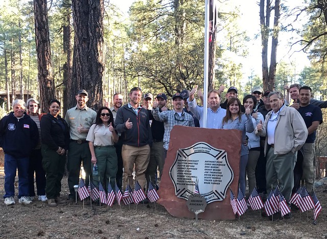
On June 30, 2013, the Yarnell Hill Fire – the deadliest U.S. wildfire in 80 years – broke out in Arizona’s Yavapai County, killing 19 Granite Mountain Hot Shot firefighters. Since then, local residents and land managers have taken steps to honor the memory of the fallen by caring for the forests that remain.
Tom Ashcraft, whose son Andrew died in the fire, lives in a neighborhood adjacent to Prescott National Forest. Joined by his wife, Jen, and six of their neighbors, they now actively manage their land to prevent damage from future wildfires.
The USDA Forest Service Forest Stewardship Program, USDA Natural Resources Conservation Service Environmental Quality Incentives Program (EQIP) and Arizona Department of Forestry and Fire Management (AZDFFM) collaborated to develop one stewardship plan to meet each landowner’s goals. Programs like Forest Stewardship and EQIP partner with state forestry agencies to connect private landowners like the Ashcrafts with the information and tools they need to manage their forests.
While U.S. forests have many owners, both public and private, wildfire doesn’t stop where one ownership ends and another begins. To battle blazes, firefighters respond across jurisdictions, managing wildland fire wherever it occurs. Forest management, however, is typically carried out piecemeal, with each landowner and land manager setting priorities and actions based on individual goals and means.
Yavapai County and the City of Prescott are working to change that mindset. United under the Prescott Area Wildland Urban Interface Commission (PAWUIC), community leaders and business, local, state, and federal agency representatives meet at least monthly to assess and mitigate wildfire threats and promote forest health across ownerships.
Through frequent coordination and careful adjustment of timelines, PAWUIC members prioritize forest management activities across the landscape to maximize cost savings and create efficiencies. Similar land management partnerships exist nationwide in many rural communities at risk of wildfire.
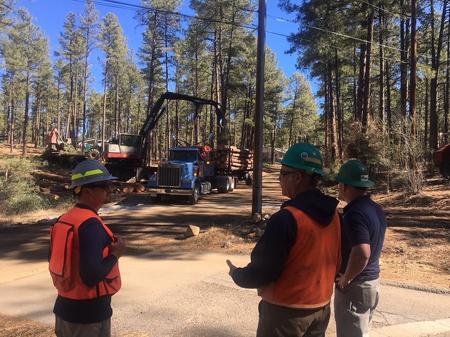
The Ashcrafts are active members of PAWUIC, as is Prescott National Forest and AZDFFM. By taking advantage of economies of scale leveraged through this partnership, they were able to treat much more forest than financial constraints might have otherwise allowed. For example, they were able to remove thickets of small trees on 19 acres of private land, and 695 acres of adjacent national forest land was treated at the same time using mechanical thinning techniques.
This area has been identified as a priority of the Joint Chiefs’ Landscape Restoration Partnership, which works to mitigate wildfire risk and improve forest health on 141,156 acres of public and private lands in the central highlands of Arizona. The private land includes a fire suppression pond built by local firefighters with help from the Granite Mountain Hot Shots. You’ll also find a memorial dedicated to the 19 firefighters who perished five years ago.