

Over the past few decades, water quality in the Jelkes Creek–Fox River watershed in northern Illinois has diminished greatly.
That’s why USDA’s Natural Resources Conservation Service collaborated with the Kane-DuPage Soil & Water Conservation District and Illinois Environmental Protection Agency in 2011 on a watershed planning process with residents, environmental groups and other stakeholders.
One of the results of the thorough process was a watershed action plan, which was funded by NRCS partner, the U.S. Environmental Protection Agency. A watershed action plan is not a legally binding document, but rather a tool to help community leaders make informed decisions about water quality in a certain area.
One change that can negatively affect water quality in a watershed is the conversion of land from wilderness or agricultural uses to urban areas.
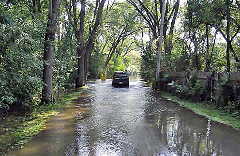
That’s because land covered with asphalt or concrete pavements can cause excessive surface water runoff from rain or snowmelt, which can contain contaminants like sediment, petroleum products from roads, and fertilizer and pesticides from yards. The water flows over the land, picking up any contaminants found there, and eventually drains into the lowest water body in the watershed—in this case Fox River and its largest tributary, Jelkes Creek.
The impermeable pavement typically used to create sidewalks and roads also reduces the amount of water that can be absorbed into the soil.
The Jelkes Creek–Fox River watershed action plan, which the conservation district developed with technical advice from NRCS, set goals for addressing water quality in the watershed—primarily reducing stormwater runoff, water pollution and soil erosion.
When the conservation district obtains funds to implement the watershed action plan, NRCS will help install the conservation practices needed to protect water quality. First, though, NRCS experts will analyze where the worst of the erosion is coming from and estimate sediment delivery so that the most problematic areas in the watershed are tackled first.
Then stormwater runoff will be reduced through the addition of rain gardens, engineered wetlands and biowales (landscaping that removes silt and pollutants). Soil erosion will be addressed with the building of stone structures that will slow the speed of water running down hills, helping to prevent soil from washing into the river.
The plan will be put into action not just by the conservation district and NRCS, but also the people who live in the watershed, says David Powleit, Jelkes Creek–Fox River Watershed Coalition member.
“The development of the watershed plan offers an opportunity for citizens to get involved with the water resources out their own backdoors,” he says.
The Kane-DuPage Soil & Water Conservation District suggests voluntary methods for residents to enhance water quality. For example, they can sweep up yard debris, plant native plants and reduce the use of fertilizer and pesticides.
Follow NRCS on Twitter.
Check out other conservation-related stories on the USDA blog.
