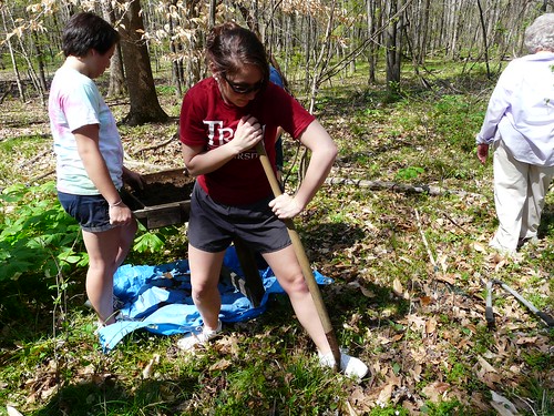
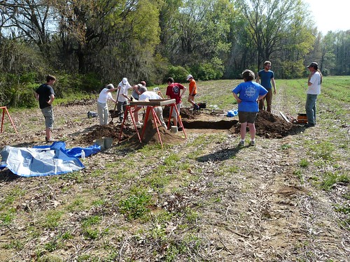
Last spring and summer I had the opportunity to investigate two 1,000 year old archeological sites on a Montgomery County farm. Working with me were archeologists from Troy University and Auburn University at Montgomery, their students and volunteers from the Alabama Archeological Society. Our goal was to determine if the two sites were important to understanding the prehistory of Alabama and should be preserved.
I was on the farm because I am the Cultural Resources Specialist for USDA’s Natural Resources Conservation Service (NRCS) in Alabama. The farmer was planning to implement conservation practices on the land with NRCS’ assistance, so my job was to review the property and planned practices to determine whether we’d be adversely affecting the two archeological sites.
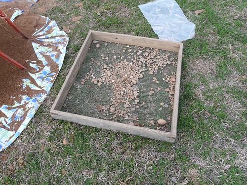
Both sites were remnants of American Indian communities from what Alabama archaeologists refer to as the Hope Hull phase (900-1100 AD). To evaluate the sites, we first looked on the soil surface for artifacts and dark brown soils that represent middens or features. We then excavated several small test holes to look for undisturbed artifacts and soil patterns that could indicate the presence of hearths, storage, garbage pits or postholes. The patterns of postholes can reveal the size and shape of houses, as well as any outbuildings or other structures built for food preparation or storage.
Our team also used ground-penetrating radar and other tools to look below the surface. We surveyed a portion of one site using a fluxgate gradiometer—a magnetometer that can help find disturbances in the subsoil—which can also help find hearths, storage pits and house postholes.
All of these efforts together provided evidence that both sites are likely eligible for the National Register of Historic Places. We think more than 180 acres of this 900-acre farm contain archeological and historic remains! Because of that, and because the farm contains several intact 19th-century structures, the entire property may even be eligible for listing in the Register.
Based on our surveys, I was able to provide the farmer with recommendations for implementing conservation practices that would protect the sites. For example, instead of deep plowing the site in one field (an activity that would severely disturb, if not destroy, the site), he has elected to use “no-till” techniques—which are also recommended as a conservation best practice by NRCS.

More field trips are planned as the investigations on this farm continue and we continue to learn about the lifeways of Native Americans of central Alabama one thousand years ago.
The excavations are being coordinated with the Alabama Historical Commission and the Poarch Band of Creek Indians, the only federally recognized tribe in Alabama. The location of the farm and the names of its owners and tenant farmer are being kept private to protect the sites.
Check out more conservation stories on the USDA blog.
Follow NRCS on Twitter.