March storms increased snowpack in the northern half of the West but didn’t provide much relief for the dry southern half, according to data from the U.S. Department of Agriculture’s National Water and Climate Center (NWCC) in its April 2014 water supply forecast.
According to the Natural Resources Conservation Service (NRCS), most of Idaho, Montana, Wyoming, and northern parts of Colorado and Utah are expected to have near normal or above normal water supplies, according to the forecast. Far below normal streamflow is expected for southern Oregon, California, Arizona, New Mexico, southern Utah and western Nevada.
Early April is commonly regarded as the transition from snow accumulation to snowmelt, making the April 1 water supply forecast of key importance for planning, according to NWCC hydrologist Cara McCarthy.
"Many water managers, reservoir operators, irrigation districts and hydroelectric power companies make significant strategic decisions based on the April forecasts," McCarthy said.
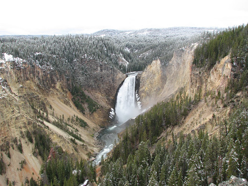
In states where snowmelt accounts for the majority of the seasonal water supply, information about snowpack serves as an indicator of future water supply. Streamflow in the West consists largely of accumulated mountain snow that melts and flows into streams as temperatures warm. NRCS scientists analyze the snowpack, air temperature, soil moisture and other measurements taken from remote sites to develop the water supply forecasts.
For the second consecutive month, many snow telemetry, or SNOTEL, sites in Montana, Wyoming, and parts of Idaho, Washington, and Oregon received two to three times the normal amount of precipitation. The Cascade Mountains in Washington went from extremely dry in January to a normal snowpack currently and Montana and Wyoming snowpack is now at record levels.
“There's flooding potential in the Missouri River basin,” McCarthy said. "These areas will be most vulnerable if snow melts rapidly during a hot spell, or if there's extreme rain while the streams are swollen with snowmelt."
NRCS’ streamflow forecasts are one of the tools used to assess drought conditions. USDA is partnering with western states to help mitigate the severe effects of drought on agriculture.
Since 1939, NRCS has conducted snow surveys and issued regular water supply forecasts. Since the late 1970s, NRCS has been installing, operating and maintaining an extensive, high-elevation automated system called SNOTEL, designed to collect snowpack and related climatic data in the western U.S. and Alaska.
The center will continue to monitor and forecast water supplies for the next two months. View the April Snow Survey and Water Supply Forecast map or view information by state. And to learn more about how NRCS is helping private landowners deal with drought, visit NRCS’ drought resources. You can also visit USDA’s disaster and drought information page.