Today, March 22, is World Water Day, and the U.S. Forest Service joins the international community in celebrating water and inspiring good stewardship of this vital resource. Forests are essential to our survival and well-being due in large part to the ecosystem services they provide, including our fresh water.
Surface water that originates on our national forests has many important purposes, one of which is providing drinking water for millions of people in the United States. Surface water is water in rivers, streams, creeks, lakes and reservoirs. Surrounding trees and forests play a major role in keeping these waterways clean and healthy.
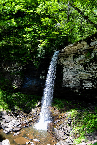
Forest trees prolong streamflow, control erosion, and maintain high-quality water. One such example is in the Monongahela National Forest in West Virginia.
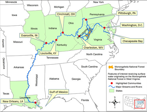
The Monongahela water system’s impact is both near and far. Streamflow that originates on the forest flows to the Chesapeake Bay and all the way to the Gulf of Mexico. During the journey, it supplies drinking water (surface water) to municipalities in nine states and the District of Columbia. This includes a number of major cities and millions of people living along the way in places like Cincinnati, Louisville, Pittsburgh and Washington.
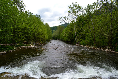
You may be wondering how in the world water from the uplands of West Virginia can provide drinking water to people located in divergent directions and so far from the national forest? It’s thanks to more than 2,600 miles of perennial streams and rivers within the Forest’s boundaries, abundant rain and snow, and the Monongahela’s position along the Eastern Continental Divide.
West Virginia lies completely within the Appalachian Mountain region. It is categorized into three major provinces – The Allegheny Plateau (west and north), the Allegheny Mountains (southwest and northeast) and Ridge Valley (east of the Allegheny Front).
The Allegheny Mountains create a rain shadow, concentrating rain in the mountains and causing the western part of the state to receive much more precipitation than the eastern panhandle. The most northeastern part of the Monongahela receives the least amount of precipitation, just under 40 inches per year on average because it lies in the rain shadow.
By contrast, high elevation areas in the central and southern parts of the Forest receive at least 60 inches of precipitation annually. Almost half of that precipitation becomes streamflow, providing drinking water for downstream communities and supporting many species of fish and other aquatic organisms.
The Eastern Continental Divide creates two divisions in this streamflow—one flowing east to the Chesapeake Bay and the other flowing west and north and eventually south to the Gulf of Mexico. This translates into drinking water and other water resources for families and businesses across a huge water shed flowing through a large part of the eastern United States including West Virginia, Maryland, the District of Columbia, Ohio, Virginia, Pennsylvania, Kentucky, Indiana, Illinois and Louisiana.
So, on World Water Day, we encourage you to raise a glass of cool, refreshing water to the forests that help keep it clean and the amazing waterways that bring it to you.